アプリ詳細
 | Garafa, LLC |
更新日:2026/10/17 02:41
カスタマーレビュー★
★☆☆☆☆
地形図が表示されないGoogle Terrain の地形図が表示されません。GPS kit を立ち上げても、方眼上のマス目が表示されるだけで、地形図が表示されません。何か設定があるんでしょうか?バージョン5、3GS、iOS4.2です。分かる方教えてください。
gravities : 2011/01/15
★☆☆☆☆
懲りずに捨てずに、毎回アップデートしてますが、相変わらず使い物になりません。落ちるし、キャッシュは不安定、インターフェイスも使いにくい。比較的高額アプリなのにココまで実用的でないのは珍しい。もっと安価なGPSアプリのほうが優秀なものがあります。
navanava : 2010/12/11
★☆☆☆☆
キャッシュ取得できずバージョンアップしてからキャッシュ取得方法が変わったらしい。で、ヘルプ動画の通りに操作したがキャッシュが取得できない。もーやだこのアプリ。
毒針 : 2010/11/10
★☆☆☆☆
No Goodこのバージョンはキャッシュの取得が難しい。取得しようとすると異常に細かいタイル選択を行うバグも存在する。もっと簡単な方法を望みます。This version has difficult acquisition of the cash.When I am going to acquire it, the bug to make careful tile choice abnormally exists.I expect a simpler method.
Mat_0640 : 2010/10/22
★☆☆☆☆
使えない落ちます…
大東亜共栄圏 : 2009/07/14
アプリ概要
スクリーンショット
説明
- TIME Magazine’s 15 Fantastic Gadgets
“Perfect for hiking or mountain biking.”
- TUAW.com
“The GPS Kit app... has a number of excellent outdoor uses, especially [for] hiking, biking or geocaching.”
- NBC’s ‘The Browser’ Radio Show
“Most beneficial for adventure-type guys.”
_________________________________________________________
Top-of-the-line GPS system for adventurers and professionals in the great outdoors.
Designed for outdoor activities such as:
hiking, hunting, camping, skiing, cycling, geocaching, mountain biking, motorcycling, off-roading, fishing, and other romping in or out of the backcountry—ANYWHERE IN THE WORLD.
GPS Kit is a full-featured GPS system for the iPhone that combines all the functionality of expensive handheld units with the power of wireless technology. Using advanced technology optimized for the iPhone, GPS Kit offers a superbly easy-to-use system that puts data from a wide range of sensors at your fingertips.
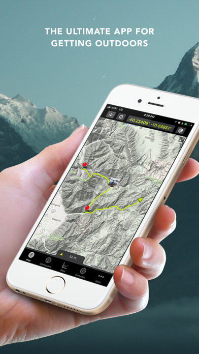
Highest Quality Mapping
- Fastest maps in the App Store
- Smooth, elegant interaction
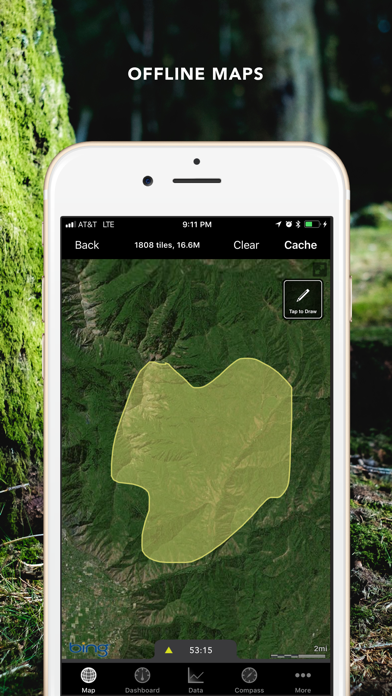
- Offline Mode enables use out of cell range
- No data connection required if map is cached
- Use your own map sources
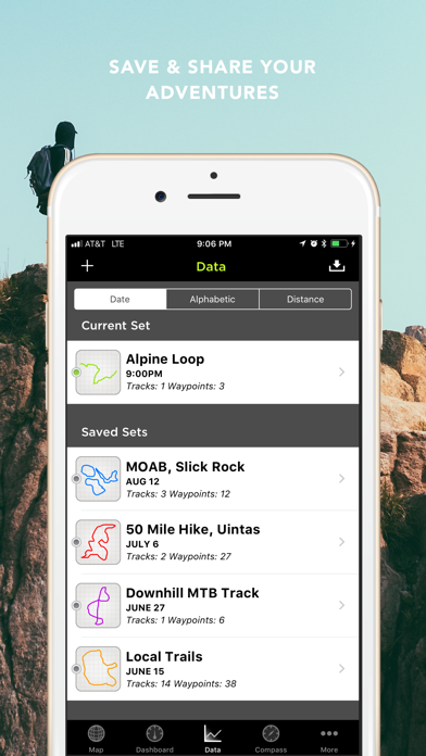
Simple, Powerful Data Handling
- Mail links for Google Earth & map viewing
- Full-color thumbnails of data sets
- Group tracks and waypoints together
- Most options for export and import of data
- Open KML, KMZ, & GPX from Mail & Safari
- Attach KML & GPX files to email
- Export GPX & KML through iTunes
- Share your adventures on Facebook and Twitter
Powerful Waypoints
- Add photos and notes to waypoints
- Drag map to reposition as coordinates update
- UTM, USNG, MGRS
- Long-press to quickly drop a waypoint
- Navigate to waypoints using compass
- Magnetic compass (3GS, 4, iPad)
- Option to use current travel direction on compass
- See distance to waypoint update in real-time
Weather Stations (U.S. Only)
- Create "weather stations" to get point forecasts
- Get data specific to your fishing hole, ski tour, etc.
- Data provided by the National Weather Service
- Unlimited stations
Intelligent Data Collection
- Uses maximum GPS accuracy
- Real satellite positioning even without cell signal
- Auto-segmentation of tracks for clean tracks
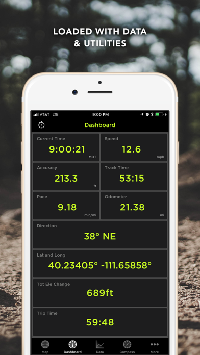
Fully Customizable Dashboard
- Gorgeous high contrast display
- Huge variety of parameters and units
- Time, Trip Time, Track Time
- Elevation Change
- Formatted Position (Lat/Lng, UTM, MGRS, USNG)
- Accuracy, Speed, Odometer, Avg Speed
- Max Speed, Pace, Avg. Pace
- Moving Time, Stopped Time, Direction
- 3-Axis Inclinometer and Glide Ratio
- Customizable cell on map
Loaded with Related Utilities
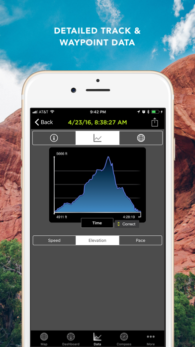
- Elevation and speed graphs
- On-map tracking controls and timer
- On-map ruler
- Multi-touch area measurements
* Use of "Squawk!" requires an Internet connection and extended use may adversely impact battery life
Continued use of GPS running in the background can dramatically decrease battery life
“Perfect for hiking or mountain biking.”
- TUAW.com
“The GPS Kit app... has a number of excellent outdoor uses, especially [for] hiking, biking or geocaching.”
- NBC’s ‘The Browser’ Radio Show
“Most beneficial for adventure-type guys.”
_________________________________________________________
Top-of-the-line GPS system for adventurers and professionals in the great outdoors.
Designed for outdoor activities such as:
hiking, hunting, camping, skiing, cycling, geocaching, mountain biking, motorcycling, off-roading, fishing, and other romping in or out of the backcountry—ANYWHERE IN THE WORLD.
GPS Kit is a full-featured GPS system for the iPhone that combines all the functionality of expensive handheld units with the power of wireless technology. Using advanced technology optimized for the iPhone, GPS Kit offers a superbly easy-to-use system that puts data from a wide range of sensors at your fingertips.
Highest Quality Mapping
- Fastest maps in the App Store
- Smooth, elegant interaction
- Offline Mode enables use out of cell range
- No data connection required if map is cached
- Use your own map sources
Simple, Powerful Data Handling
- Mail links for Google Earth & map viewing
- Full-color thumbnails of data sets
- Group tracks and waypoints together
- Most options for export and import of data
- Open KML, KMZ, & GPX from Mail & Safari
- Attach KML & GPX files to email
- Export GPX & KML through iTunes
- Share your adventures on Facebook and Twitter
Powerful Waypoints
- Add photos and notes to waypoints
- Drag map to reposition as coordinates update
- UTM, USNG, MGRS
- Long-press to quickly drop a waypoint
- Navigate to waypoints using compass
- Magnetic compass (3GS, 4, iPad)
- Option to use current travel direction on compass
- See distance to waypoint update in real-time
Weather Stations (U.S. Only)
- Create "weather stations" to get point forecasts
- Get data specific to your fishing hole, ski tour, etc.
- Data provided by the National Weather Service
- Unlimited stations
Intelligent Data Collection
- Uses maximum GPS accuracy
- Real satellite positioning even without cell signal
- Auto-segmentation of tracks for clean tracks
Fully Customizable Dashboard
- Gorgeous high contrast display
- Huge variety of parameters and units
- Time, Trip Time, Track Time
- Elevation Change
- Formatted Position (Lat/Lng, UTM, MGRS, USNG)
- Accuracy, Speed, Odometer, Avg Speed
- Max Speed, Pace, Avg. Pace
- Moving Time, Stopped Time, Direction
- 3-Axis Inclinometer and Glide Ratio
- Customizable cell on map
Loaded with Related Utilities
- Elevation and speed graphs
- On-map tracking controls and timer
- On-map ruler
- Multi-touch area measurements
* Use of "Squawk!" requires an Internet connection and extended use may adversely impact battery life
Continued use of GPS running in the background can dramatically decrease battery life
リリース情報
Bug fixes
Previous Release:
- updated to 64 bit
- updated for new screen sizes
- fixed weather stations
- fixed sharing
Previous Release:
- updated to 64 bit
- updated for new screen sizes
- fixed weather stations
- fixed sharing